R package - waveformlidar data processing and analysis
Make waveform lidar processing become easier and enable users can use exisitng Discrete-return lidar data processing tools.
Introduction:
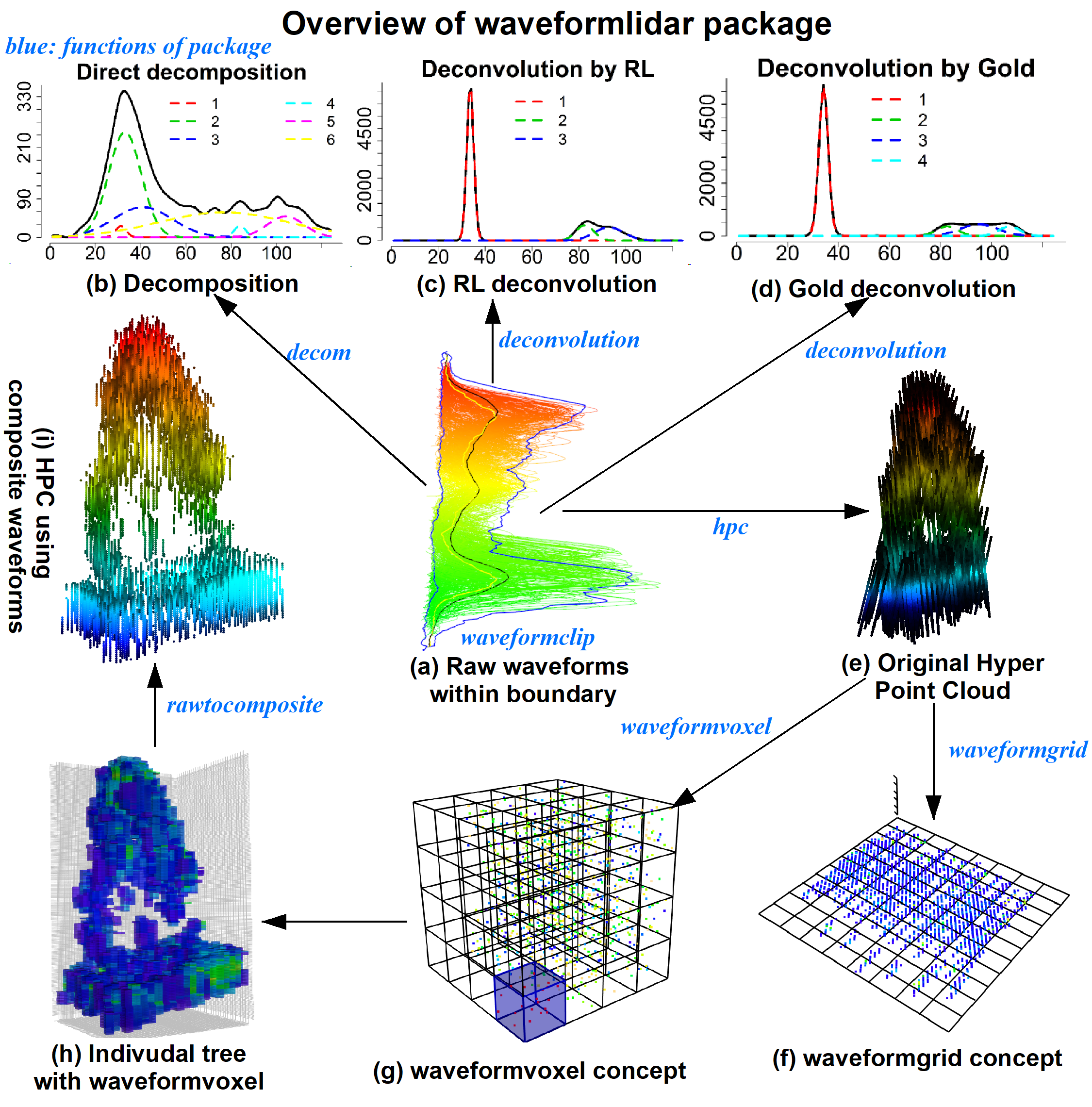
A wealth of Full Waveform (FW) LiDAR data are available to the public from different sources, which is poised to boost the extensive application of FW LiDAR data. However, we lack a handy and open source tool that can be used by potential users for processing and analyzing FW LiDAR data. To this end, we introduce waveformlidar, an R package dedicated to FW LiDAR processing, analysis and visualization as a solution to the constraint. Specifically, this package provides several commonly used waveform processing methods such as Gaussian, adaptive Gaussian and Weibull decompositions, and deconvolution approaches (Gold and Richard-Lucy (RL)) with users customized settings. In addition, we also develop some functions to derive commonly used waveform metrics for characterizing vegetation structure. Moreover, a new way to directly visualize FW LiDAR data is developed through converting waveforms into points to form the Hyper Point cloud (HPC), which can be easily adopted and subsequently analyzed with existing discrete-return LiDAR processing tools such as LAStools and FUSION. Basic explorations of the HPC such as 3D voxelization of the HPC and conversion from original waveforms to composite waveforms are also available in this package. All of these functions are developed based on small-footprint FW LiDAR data, but they can be easily transplanted to the large footprint FW LiDAR data such as Geoscience Laser Altimeter System (GLAS) and Global Ecosystem Dynamics Investigation (GEDI) data analysis.
Project link: https://github.com/tankwin08/waveformlidar